

You come up from the coast, the air cools, the tea starts, and everyone tells you the same thing: go to Ella. And they are not wrong. Ella has the Nine Arch Bridge, Little Adam's Peak, good coffee and a genuinely lovely setting. It has earned its reputation.
But there is a question worth asking before you book: what if you stayed one ridge away?
Haputale sits on the same railway line, on the same escarpment, in the same tea country — and almost nobody stops. Most travellers pass through its station without looking up. That is a planning habit rather than a judgement of the place, and it is worth examining, because the two towns are not really competing for the same traveller.
Ella is a destination. Haputale is a gateway. The difference is not which is better — it is what you want a hill-country base to do for you.
Haputale in One Sentence
Haputale is where Sri Lanka's tea country, mountain roads, colonial heritage and long-range viewpoints meet on a single ridge.
The town sits at roughly 1,430 metres in the Badulla District of Uva Province, strung along a narrow ridge that falls away steeply on both sides. That geography is the whole story. On a clear morning the land drops south toward the coastal plain; when cloud comes in — and it comes in most afternoons — the town sits above it. The railway runs straight through the middle and tea estates cover almost everything else.
The Real Advantage: A Base, Not a Stop
Listing what is in Haputale undersells it, because the town's value is what it puts within reach. Think of it as a hub with spokes:
Stay in one place. Explore several landscapes.
That is a materially different proposition from "the town has nice views." It means you can unpack once and still see tea country, waterfall country, cloud forest and high plateau.
The Mountains Begin at the Door
The drive up is not the dull part before the good part. Coming from Bandarawela or Beragala the road climbs through switchbacks with tea on both sides, and the vegetation changes as you gain height — jak and banana giving way to eucalyptus, pine and cropped tea. Villages appear on the verge: a tea kiosk, a temple, a row of estate line houses, then nothing again.
Then the ridge, and the drop. On a clear run you can see a long way south. On a misty one you drive into cloud and out of it within a kilometre, repeatedly. Either version earns the window seat, which is the argument for treating this leg as an experience with stops rather than a transfer to be minimised.
Lipton's Seat: Where the Tea Country Opens Up
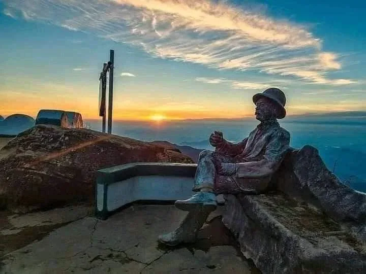
Sir Thomas Lipton was a Glasgow grocer who understood something his competitors did not: if you own the estates, you control the price. In 1890 he bought into Ceylon and established the Dambatenne Tea Factory, and the story goes that he would climb to a bench on the ridge above Poonagala to survey what he had acquired. That bench is now Lipton's Seat, at roughly 1,970 metres.
You will see the phrase "360-degree view" attached to this place constantly. Treat it with scepticism — the ridge itself blocks part of the arc. What is true, and enough, is that on a clear morning the tea country falls away below the viewpoint in layers, ridge behind ridge, valleys opening between them and cloud moving through at eye level.
Go early. This is not a preference, it is the whole trip: by mid-morning cloud usually fills the valleys and the view closes. The classic approach is the roughly seven-kilometre walk up from the Dambatenne factory through the estates — steep, beautiful, and best begun well before dawn. A vehicle can take you most of the way if walking is not realistic.
The factory itself still works, much of the original Victorian machinery still in place. Tours run, and watching withering troughs and rolling machines in operation is a better introduction to Ceylon tea than any tasting room.
The Colonial Layer
Haputale was built by the tea industry and it still looks it. The British needed a rail head to move tea, so the line came through; planters needed somewhere to live, so bungalows went up on the good aspects; the estates needed labour, so line housing filled the slopes. The result is a town whose architecture is unusually legible — you can read the industry off the buildings.
The station is a working piece of colonial railway infrastructure rather than a heritage exhibit. Estate bungalows still stand on the ridges, some now guesthouses. There are churches from the planting era. None of it is curated or ticketed, which is part of the appeal — here the colonial period is simply the built environment, not an attraction.
Adisham: A Tudor House Turned Monastery
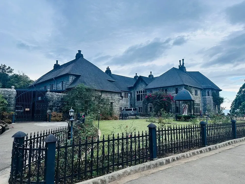
Adisham is the strangest and best thing near Haputale, and the story is better than the building.
It was built in 1931 for Sir Thomas Lister Villiers — a grandson of Lord John Russell, descendant of the Dukes of Bedford, and chairman of the Colombo trading house George Steuart & Co. He wanted an English country house in the Sri Lankan highlands and he got one: designed by R. Booth and F. Webster in Tudor and Jacobean style, in grey granite, on ten acres, with gardens to match. For a time it was where colonial Ceylon's establishment came to stay.
Then Villiers retired, the house was sold to Sedawatte Mills, and in 1961 it was bought by the Roman Catholic Church and became a monastery. It now houses the Adisham Monastery of the Congregation of St Sylvester, a Benedictine congregation. Monks live and work there. There is a library, a chapel, orchards, and a small shop selling jam and cordial made from fruit grown on site.
The contrast is the point: tea plantations, mountain weather, an English manor house and a monastic community, all within the same twenty minutes. Only part of the building is open to visitors and access is limited — this is a religious community, not a museum. Check current opening arrangements before travelling, dress modestly, and keep quiet in the areas in use.
The Koslanda Connection
Drop off the escarpment south-east and the climate changes fast. Within a short drive you are out of the tea and into a warmer, wetter, more forested landscape around Koslanda, on the A4. This is where Haputale's position pays off — you can have breakfast in cloud and be standing at the foot of a major waterfall before lunch.
Diyaluma Falls
Diyaluma is 220 metres high — the second-highest waterfall in Sri Lanka — and it sits about six kilometres from Koslanda, visible from the main road. That roadside view is the easy version, and it is genuinely impressive.
The upper falls are another experience entirely: a climb through scrub and rock to a series of natural pools at the top, where the water gathers before going over. It is popular, photogenic, and considerably more serious than social media makes it look. The rock is slick, the route is unmarked in places, and the flow changes quickly after rain upstream.
On swimming. People have been killed and seriously injured at the upper pools. Conditions vary with rainfall and are not always obvious from the bank, and there are no lifeguards. Go with someone who knows the site, avoid it after heavy rain, do not swim near the lip, and treat any assurance that a particular pool is "safe" as conditional on that day's water. If you are not confident, the view from below costs nothing and asks nothing of you.
Devil's Staircase: The Adventurous Side
This is the one that separates Haputale from a standard hill-country stop. The Devil's Staircase runs roughly fourteen kilometres through the highlands, linking the Ohiya area near Horton Plains with the A4 at Kalupahana. The name comes from the hairpins: the steepest section climbs about 120 vertical metres up the Haputale ridge in a stack of switchbacks.
It is an estate road, not a highway. The surface is rough, sections wash out, and there is essentially nothing along it — no fuel, no shops, patchy signal. It passes through tea estates, past waterfalls and along ridges with drops that would concern most people. Some walk it as a full-day hike; some drive it in a suitable high-clearance 4WD with someone who has been there before.
Do not attempt it in an ordinary car, in bad weather, or late in the day. Take a local driver or guide. This is the kind of route where the right vehicle and the right person are the whole difference between a great day and a genuine problem.
Baker's Bend
On the Nonpareil Estate road on the Belihuloya side, bordering Horton Plains, is a horseshoe bend at around 1,500 metres with a long view out over the low country. It is the twenty-third of some thirty-three hairpins on that road, which tells you most of what you need to know about the drive.
Two stories circulate about the name. One says the explorer Samuel Baker, who founded the settlement at Nuwara Eliya, died in a cart accident here. The other says an estate manager named William Baker lost his horse over the edge and was badly injured. The first does not survive checking — Samuel Baker died in Devon, in England, in 1893 — so treat it as local lore rather than history. The second is plausible but we have found no primary source for it. The bend is worth the drive regardless; the naming is simply unresolved.
The Road Toward Horton Plains
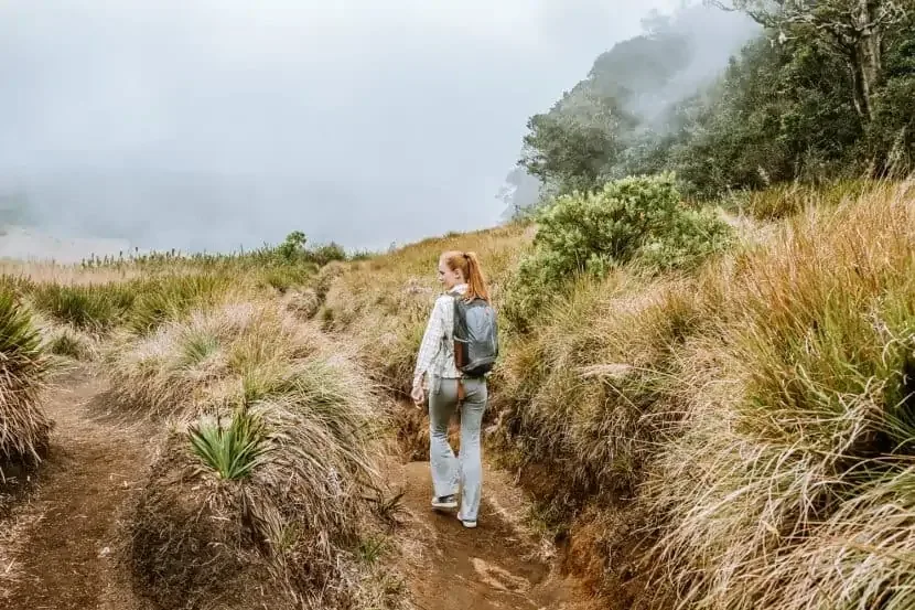
Head north from the ridge via Ohiya and the landscape climbs through a sequence you can watch happen: tea estates, then cloud forest, then the open montane grassland of the Horton Plains plateau. World's End and Baker's Falls are the headline sights, and the plateau has to be walked early — the escarpment view usually closes in cloud by around nine or ten in the morning.
Horton Plains is reachable from several bases, Nuwara Eliya included. What Haputale offers is the Ohiya approach and, more usefully, the option of combining the plateau with the Devil's Staircase or Baker's Bend on the same circuit rather than doubling back.
Haputale vs Ella: Different, Not Better
| Experience | Ella | Haputale |
|---|---|---|
| Atmosphere | Lively, social | Quiet, workaday |
| Cafés and nightlife | Strong | Limited |
| Tea-country scenery | Excellent | Excellent |
| Colonial character | Some | Strong |
| Signature viewpoint | Little Adam's Peak, Ella Rock | Lipton's Seat |
| Adisham Hall | — | Yes |
| Working tea factory | Nearby estates | Dambatenne, on the doorstep |
| Diyaluma access | Possible | Closer, via Koslanda |
| Devil's Staircase | Longer approach | Regional base |
| Horton Plains | Possible | Possible, via Ohiya |
| Crowds | Heavy in season | Light |
| Road-trip potential | Strong | Excellent |
Who Should Choose Haputale
- Couples wanting quiet — sunrise at the viewpoint, an empty ridge, no queue for anything.
- Photographers — mist, tea geometry, long light, colonial stonework, and viewpoints you will not be sharing.
- Adventure travellers — the Devil's Staircase, upper Diyaluma, long estate walks.
- Slow travellers — a working town where you can spend three days and stop being a tourist.
- Repeat visitors — if you have already done Ella, this is the obvious next move.
Who Should Still Choose Ella
Plenty of people, and it would be dishonest to pretend otherwise. Choose Ella if you want restaurants with range, a bar in the evening, other travellers to talk to, yoga and cooking classes, easy walk-out access to famous sights, and the reassurance of a town set up for visitors. First trips with limited days often work better based in Ella.
Haputale has a modest strip of local eateries and little in the way of evening life. If that sounds like a shortcoming rather than a feature, believe yourself.
The question is not whether Ella is worth visiting. It is whether Ella is the only hill-country town worth considering. It isn't.
A Four-Day Haputale Base
Day 1 — Arrive
Up from Kandy or Nuwara Eliya by road or rail. Settle in, walk the ridge, watch the cloud come up the valley at sunset.
Day 2 — Tea day
Leave in the dark for Lipton's Seat. Dambatenne factory afterwards. Adisham in the afternoon, subject to opening. Back before the rain.
Day 3 — Down to waterfall country
Koslanda and Diyaluma. The roadside view at minimum; the upper pools only with a guide and settled weather.
Day 4 — Choose by weather
Horton Plains if it is clear, the Devil's Staircase or Baker's Bend if the vehicle and conditions allow. Keep this day deliberately undecided.
When to Go
Uva runs on a different rainfall rhythm from the west of the island. Broadly, the drier and clearer windows here fall from around January to April and again around July to September, with the north-east monsoon bringing the wettest weather roughly October to January. Mornings are the clearest part of any day, in any month. Waterfalls are at their most dramatic after rain and at their safest once levels have settled — two things that rarely coincide.
One reframe worth carrying: mist here is not bad weather. Watching cloud pour over a ridge and swallow a tea field is one of the things this landscape does best. Plan the long views for dawn and let the rest of the day be what it is.
Where to Stay
- Colonial-era bungalows and planters' houses — period rooms, fireplaces, gardens. For travellers who want the heritage to be part of the stay.
- Ridge-view hotels — built for the panorama. Worth paying for the aspect rather than the room.
- Tea-estate stays — usually out of town, often the best food, and the closest you get to how the estates actually run.
- Small guesthouses — family-run, inexpensive, and the reason many people end up staying an extra night.
Doing It Properly
- Give it three nights. One night gets you a viewpoint and a drive. The gateway idea only works with time.
- Start before dawn for the long views. Non-negotiable at Lipton's Seat and Horton Plains.
- Match the vehicle to the road. The Devil's Staircase and the estate roads need clearance and a driver who knows them.
- Stay inside the train. Hanging out of the doorway of a moving carriage is the defining hill-country photograph, and it has killed and maimed people on this line. The view through an open window is identical.
- Treat estate workers as people, not scenery. Tea pluckers are at work. Ask before photographing, accept no for an answer, and remember that estate wages and housing remain a live social issue in this region — a plantation is somebody's workplace and home.
- Respect Adisham as a religious house. Limited access, modest dress, quiet.
- Check the weather and keep a day flexible. The highlands will decide your itinerary whether you let them or not.
- Carry cash and warm layers. ATMs are limited, and it drops to single figures at night on the ridge.
The Final Argument
Haputale is not trying to replace Ella, and it would lose that fight anyway — fewer restaurants, less to do after dark, nothing with the immediate visual punch of the Nine Arch Bridge.
What it has is a ridge you can watch weather move across, a Glasgow grocer's viewpoint at nearly two thousand metres, a Tudor manor full of Benedictine monks, a road most drivers refuse, and the second-highest waterfall on the island an hour downhill. It also has the thing hardest to manufacture and easiest to lose: quiet.
Ella may be the name everyone knows. Haputale may be the place you remember.
If your idea of Sri Lanka's hill country involves more than cafés and a queue at a viewpoint, put it on the map.
Frequently Asked Questions
Is Haputale worth visiting instead of Ella?
It depends what you want. Haputale suits travellers after quiet, scenery, colonial heritage and access to remote mountain routes. Ella suits those who want cafés, nightlife, a social scene and famous sights close to town. Many itineraries fit both, since the two sit on the same railway line.
How high is Lipton's Seat, and is the view really 360 degrees?
Around 1,970 metres, above the Dambatenne estate. The "360-degree" claim is widely repeated and overstated — the ridge blocks part of the arc. What you get is a sweeping panorama across tea country and valleys, and it is worth the early start.
Can I drive the Devil's Staircase in a normal car?
No. It is a rough estate track of roughly 14 km with steep hairpins and washouts, and it needs a high-clearance vehicle and an experienced driver. In poor weather it should not be attempted at all. Many people walk it instead, as a full-day hike.
Is it safe to swim at Diyaluma Falls?
The upper pools carry real risk. There have been deaths and serious injuries, conditions change quickly with rainfall upstream, the rock is slippery, and there is no supervision. Go with someone who knows the site, avoid it after heavy rain, and consider the view from the base instead.
How many days should I spend in Haputale?
Three nights is the useful minimum to make the gateway idea work — one for the tea country and Adisham, one for Diyaluma, one held flexible for Horton Plains or the mountain roads. Two nights covers Lipton's Seat and one excursion.
Sources and Further Reading
- Adisham Hall — construction in 1931 for Sir Thomas Lister Villiers, architects R. Booth and F. Webster, and the 1961 transfer to the Roman Catholic Church and the Congregation of St Sylvester
- Diyaluma Falls — height of 220 m and status as Sri Lanka's second-highest waterfall
- Dambatenne Tea Estate and Factory — established by Sir Thomas Lipton in 1890
- Department of Wildlife Conservation — Horton Plains National Park access and opening hours
- Sri Lanka Railways — Main Line timetables and hill-country services
Road conditions, opening arrangements and water levels in this region change with weather and season. Confirm locally before travelling, particularly for Adisham, Horton Plains and any route on the estate roads.
Photo Gallery
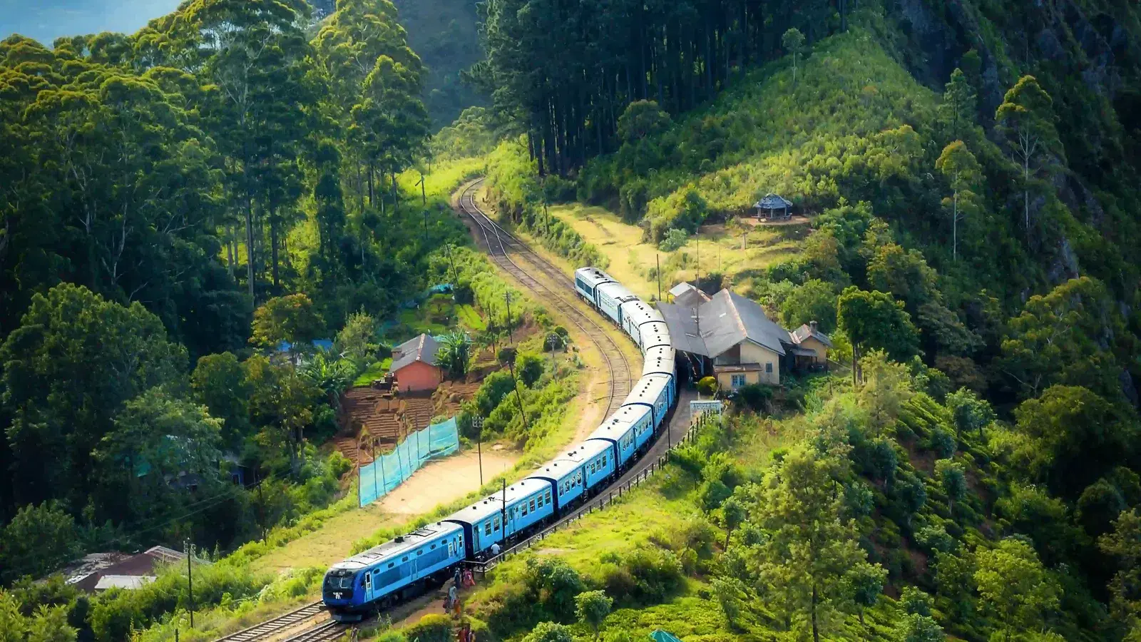
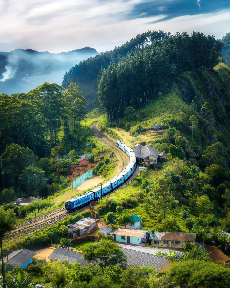
The Hill Country Line
The main line curving through a ridge village in the Uva highlands — the railway that made towns like Haputale possible, and still runs through the middle of them.
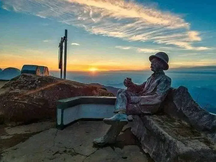
Lipton's Seat at Sunrise
The statue of Sir Thomas Lipton at the viewpoint above the Dambatenne estate, at roughly 1,970 metres. The long views close as cloud fills the valleys later in the morning.
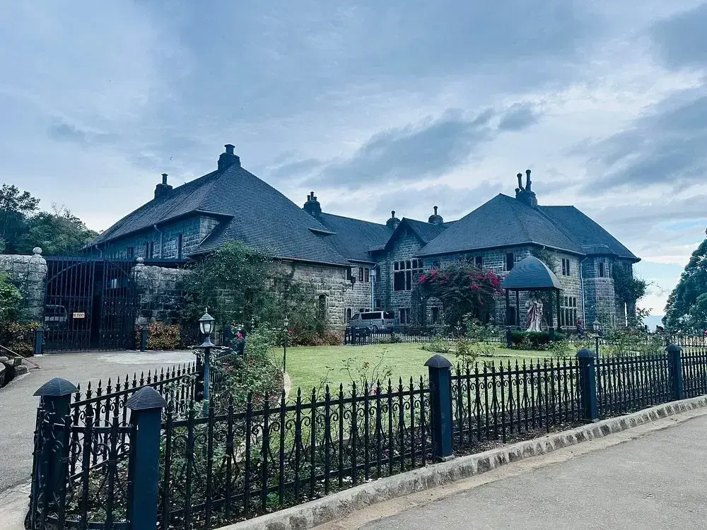
Adisham Hall
Built in 1931 for Sir Thomas Lister Villiers in Tudor and Jacobean style, and a Benedictine monastery of the Congregation of St Sylvester since 1961.
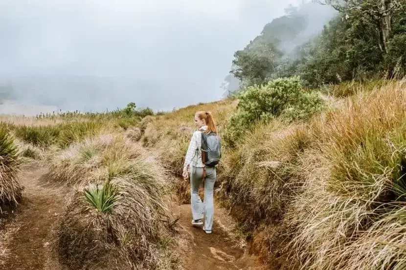
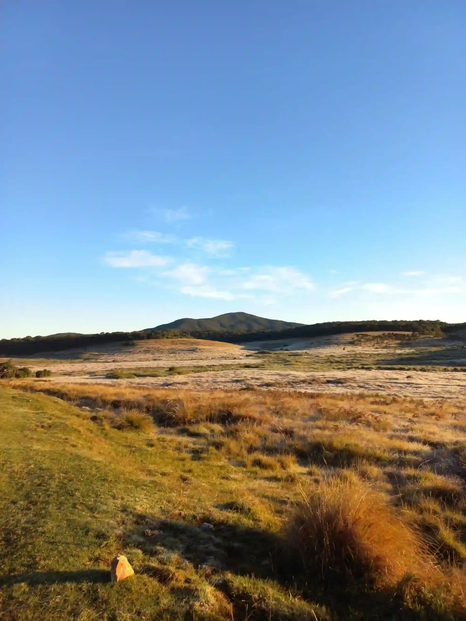
Montane Grassland Above the Tea
Above roughly 2,000 metres the tea gives out and montane grassland takes over — the landscape of the Horton Plains plateau, reached from Haputale via Ohiya.
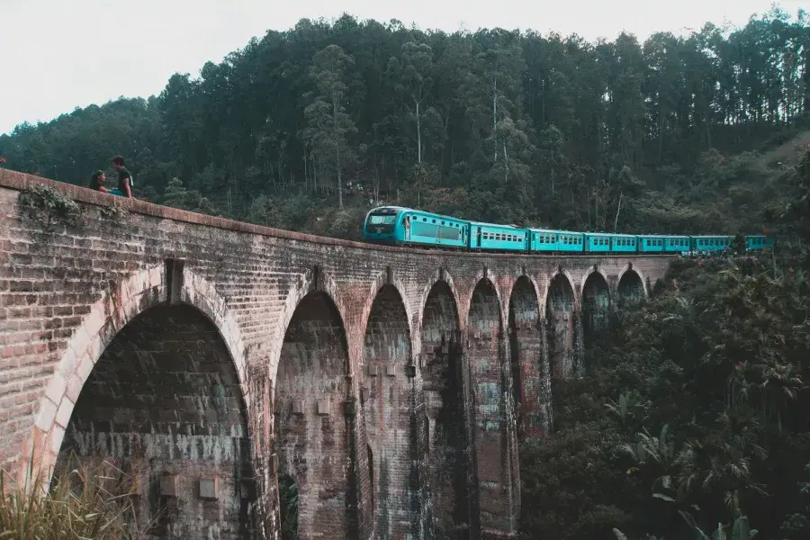
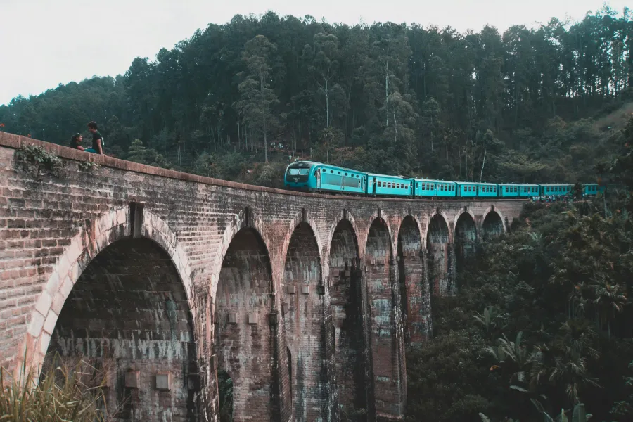
Nine Arch Bridge, Ella
Ella's best-known sight. The two towns sit on the same railway line and suit different travellers rather than competing.