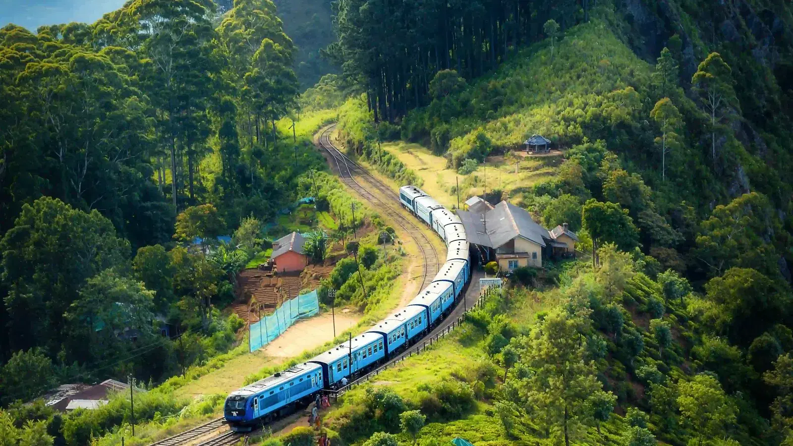


You arrive in the dark. The road up from Ohiya or Pattipola is narrow and cold, the windows fog on the inside, and when you step out at the park entrance the air has an edge to it that does not belong to the Sri Lanka most travellers know. In February there may be frost on the grass. Your breath shows. Somewhere below, the coconut coast is already warm.
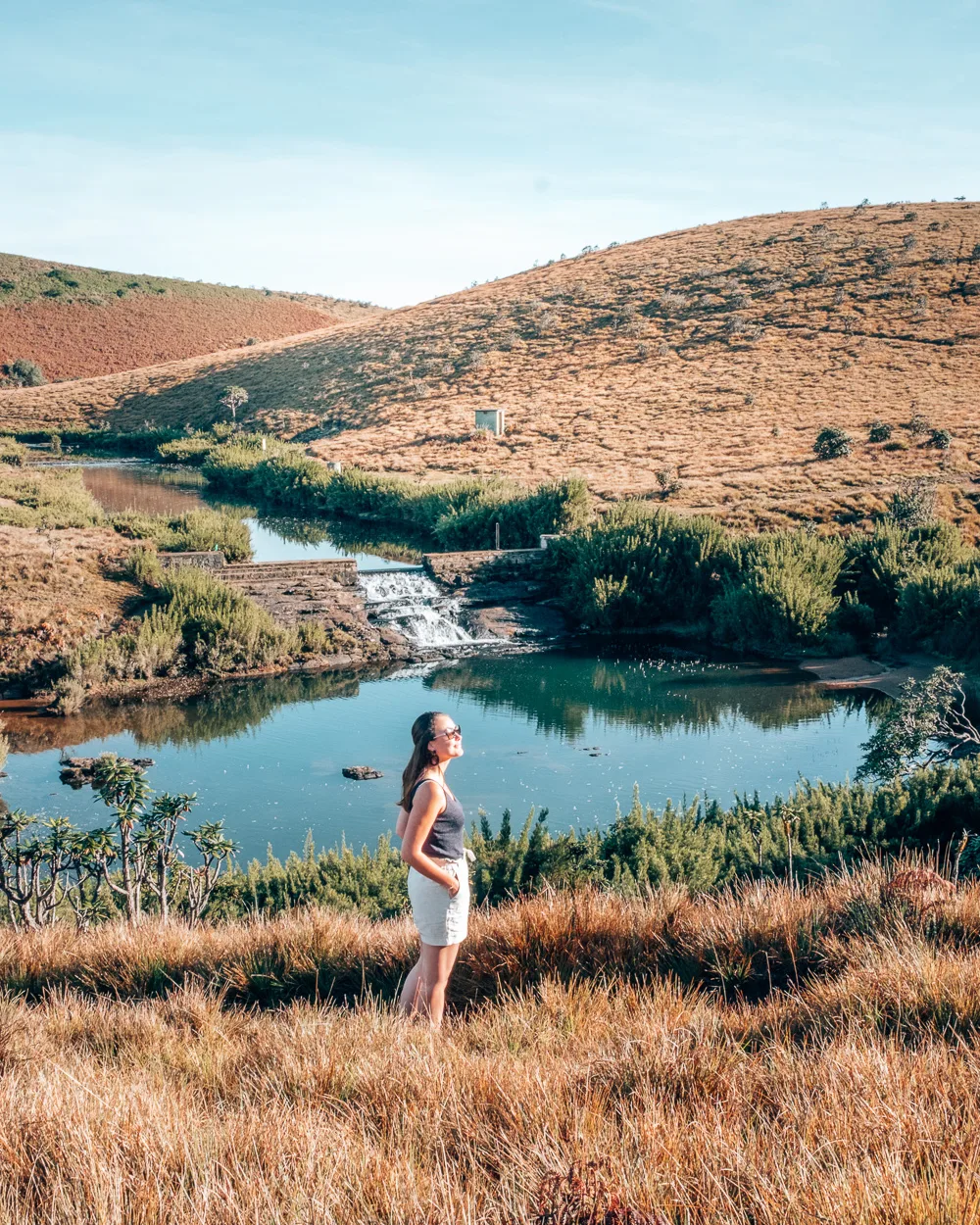
Then the trail opens onto open golden grassland, and the mist starts moving through it.
Almost everyone walks this trail for the same reason: to stand at World's End before the cloud closes it. That is a fine reason. But the cliff is the least interesting thing here, and the mist you are walking through is not scenery. It is the mechanism. Horton Plains is one of the places where Sri Lanka's water is made.
The mist drifting through these forests is not just what makes Horton Plains beautiful. It is part of a natural system that captures moisture from the air, feeds it into soil and peat, and releases it as the headwaters of the Mahaweli, the Kelani and the Walawe.
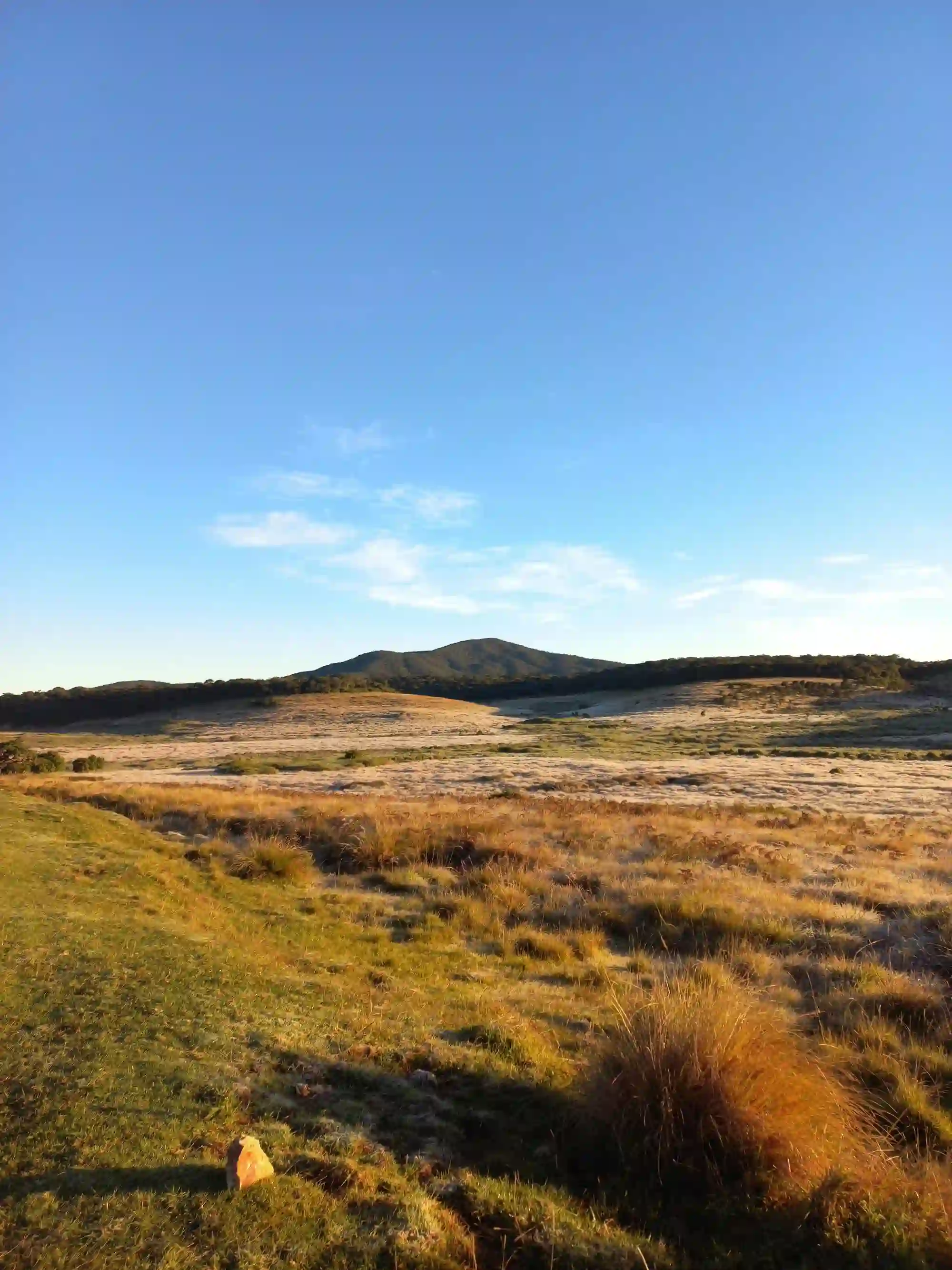
"Maha Eliya" — The Great Open Plain
Long before it carried an Englishman's name, this plateau was Maha Eliya — the great open plain. It was renamed after Sir Robert Wilmot-Horton, British Governor of Ceylon from 1831 to 1837, who visited in 1836.
People were here a great deal earlier than either name suggests. Stone tools of the Balangoda culture have been recovered in the region, and the Department of Wildlife Conservation's own park literature points to fossil evidence of a pre-farming culture in the area roughly 14,000 to 10,000 years ago, along with evidence of increased precipitation at the very end of the Pleistocene. This high, cold plateau has been part of human Sri Lanka for a very long time.
Protection came late and in stages. Horton Plains was declared a Nature Reserve on 5 December 1969 and upgraded to National Park status in March 1988 — explicitly because of its watershed and biodiversity value. In 2010, together with the Peak Wilderness Protected Area and the Knuckles Conservation Forest, it was inscribed on the UNESCO World Heritage List as the Central Highlands of Sri Lanka, under natural criteria (ix) and (x) — for ongoing ecological processes, and for containing the only habitat of many threatened species on Earth.
Horton Plains at a Glance
Rainfall figures vary by source and measuring station. The Department of Wildlife Conservation's park literature cites more than 5,000 mm annually from both monsoons plus inter-monsoonal rain; other published summaries give figures above 2,000 mm. Either way, this is among the wettest and most important catchments in the country.
The Misty Montane Forest — The Soul of the Place
Walk off the grassland into the forest and the temperature drops again. The canopy here is low — around 20 metres, a fraction of a lowland rainforest — because at this altitude, wind, cold and thin soils keep trees short and dense. Trunks are gnarled and lean. Everything is upholstered: mosses on the branches, lichens on the bark, ferns in every fork, orchids and epiphytes riding on other plants. The ground layer is Selaginella and moss, soft and permanently damp.
This is a cloud forest, and the distinction matters. A rainforest is watered by rain. A cloud forest is also watered by cloud — by mist physically condensing on leaves, moss and lichen and dripping to the ground. Ecologists call it occult or horizontal precipitation, and in high montane systems it can add a substantial share of the total water input. The forest is not just sitting in the weather. It is harvesting it. This is what people mean when they talk about the misty forests of Horton Plains: not a weather condition the trees endure, but the supply line they live on.
That is why the shaggy, moss-laden look of these trees is functional rather than decorative. Every epiphyte and every cushion of moss is extra surface area for catching fog. Strip the forest and you do not merely lose trees — you lose the apparatus that converts passing cloud into ground water.
Sri Lanka's Natural Water Tower
If you take one idea away from this article, take this one.
Horton Plains is the highest plateau in Sri Lanka, and it sits directly in the path of both the southwest and northeast monsoons. Moisture comes off the Indian Ocean, is forced upward by the central massif, cools, and falls — as rain, and as the near-permanent mist that gives the place its character. What happens next is the important part.
The water does not simply run off. The montane forest breaks the force of the rain and slows it. The dense tussock grassland binds the soil and holds the slope together. Beneath both lie deep organic soils, wetlands and peat bogs — the trail toward Kirigalpoththa crosses ground the park's own guide describes as partially degraded organic matter — and peat behaves like a sponge. It absorbs during the wet months and releases slowly through the dry ones.
The result is that streams here run when they would otherwise have stopped. And these are not minor streams.
How the Water Tower Works
The Mahaweli is Sri Lanka's longest river and the backbone of the country's largest irrigation and hydropower scheme. The Kelani supplies a large share of Colombo's drinking water. The Walawe irrigates the southern dry zone. All three begin, in part, in the soaked ground you are walking across on the way to World's End.
Why this reframes the visit. A rice farmer in Polonnaruwa, a turbine at Victoria Dam and a tap in Colombo are all downstream of this plateau. Damage to a highland catchment does not stay in the highlands — it travels, and it arrives as less water, more erratically, further away. Horton Plains is not a scenic reserve that happens to be wet. It is infrastructure with a forest on top.
A Mosaic: Grassland, Forest and Everything Between
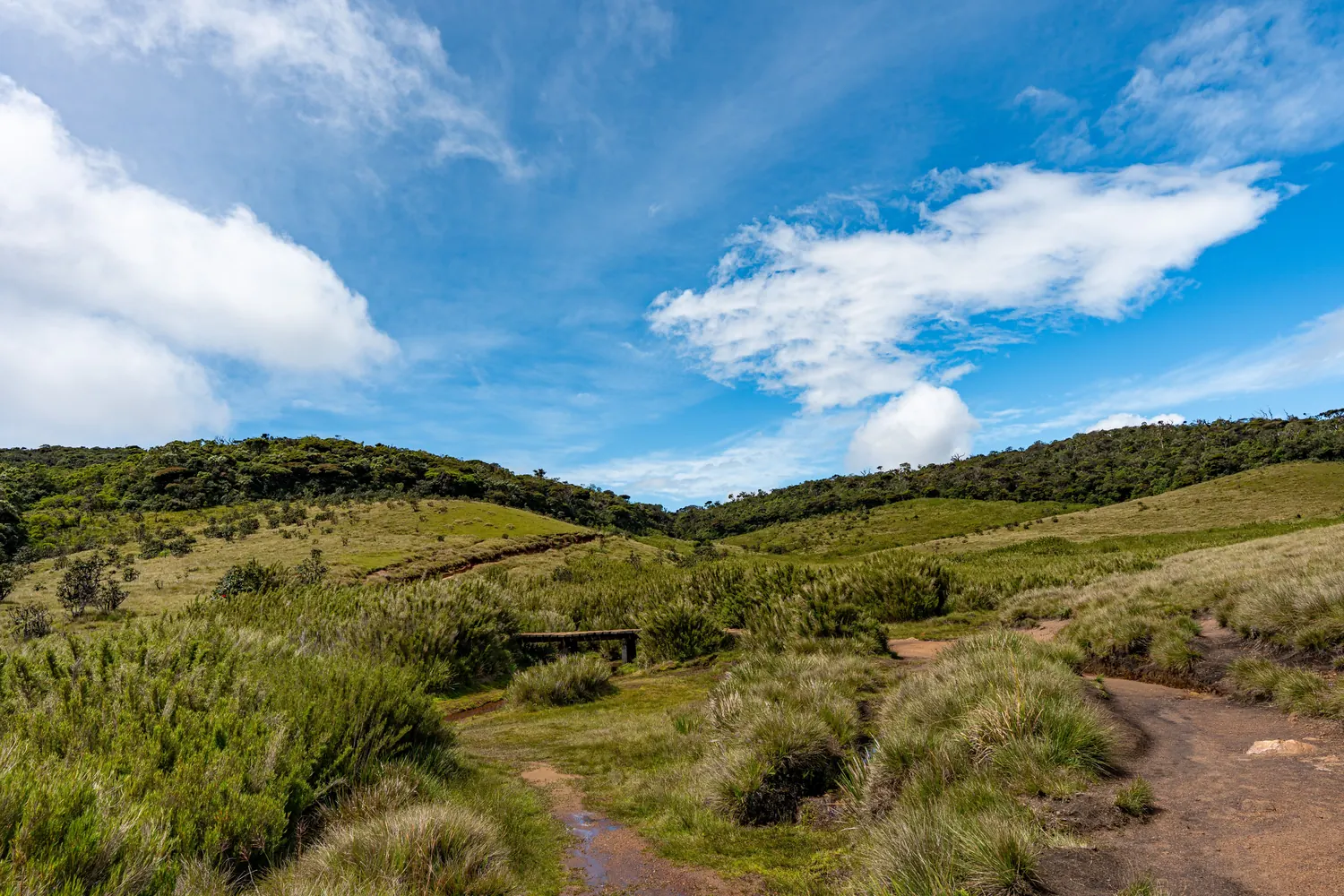
The park has two dominant vegetation types, and the boundary between them is one of the most distinctive things you will see anywhere in Sri Lanka.
Wet Patana Grassland
Roughly two-thirds of the park. Classified as upper montane grassland (Perera, 1969), it is a dense sward of tussock grasses — Chrysopogon zeylanicus (tuttiri), Arundinella villosa and Garnotia mutica (gawara) — that turns gold in the dry months and holds frost on cold mornings.
Its job: binding steep soils against 5,000 mm of rain, and providing the open grazing that supports the park's sambar population.
Montane Evergreen Cloud Forest
Roughly a third, in patches and along stream valleys. A low, dense, moss-hung canopy of Calophyllum, Syzygium, Elaeocarpus, Gordonia and Symplocos, with an understorey of Strobilanthes (nelu) and endemic dwarf bamboo.
Its job: fog capture, water storage, and shelter, food and breeding habitat for nearly everything that lives here.
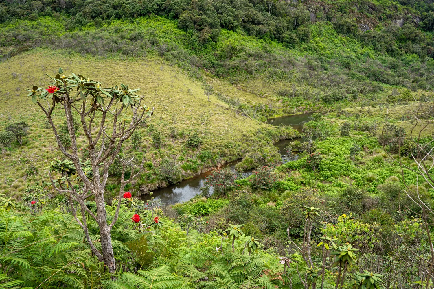
There is a third form worth knowing about, and it is strange enough to be worth the detour. On the exposed upper slopes of Thotupola Kanda the montane forest shrinks into pygmy forest — the same species, the same structure, but only about one to two metres tall where the sheltered forest below reaches six to eight. Constant wind and a thin soil layer stunt it into a waist-high woodland you look down on rather than up into. It is a genuinely odd sensation, and it is one of the clearest illustrations anywhere on the island of altitude and exposure writing themselves directly into vegetation.
Wildlife: Discovered Rather Than Displayed
Set your expectations correctly and Horton Plains is superb. Bring Yala expectations and you will be disappointed by a world-class place for the wrong reasons. Horton Plains wildlife rewards patience and an early start far more than it rewards luck, which is the opposite of how a lowland Sri Lanka wildlife tour usually works.
There is no jeep safari here. You walk, quietly, and the highland fauna is mostly small, mostly cryptic and mostly busy in the hours around dawn. In Horton Plains, wildlife is discovered rather than displayed.
The Sambar — The One You Will Almost Certainly See
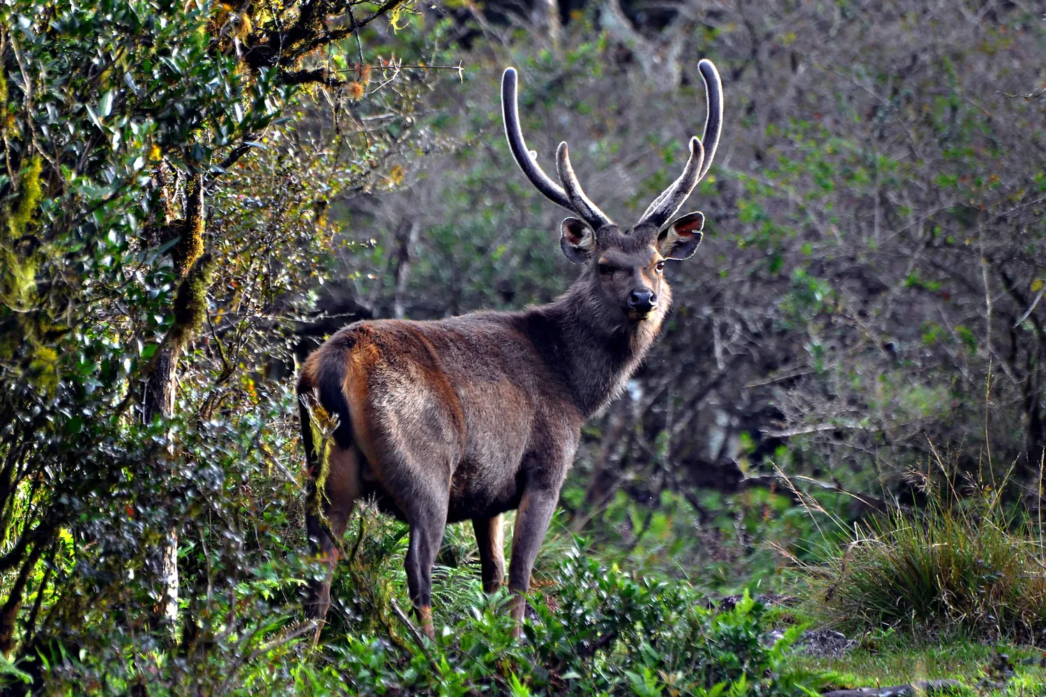
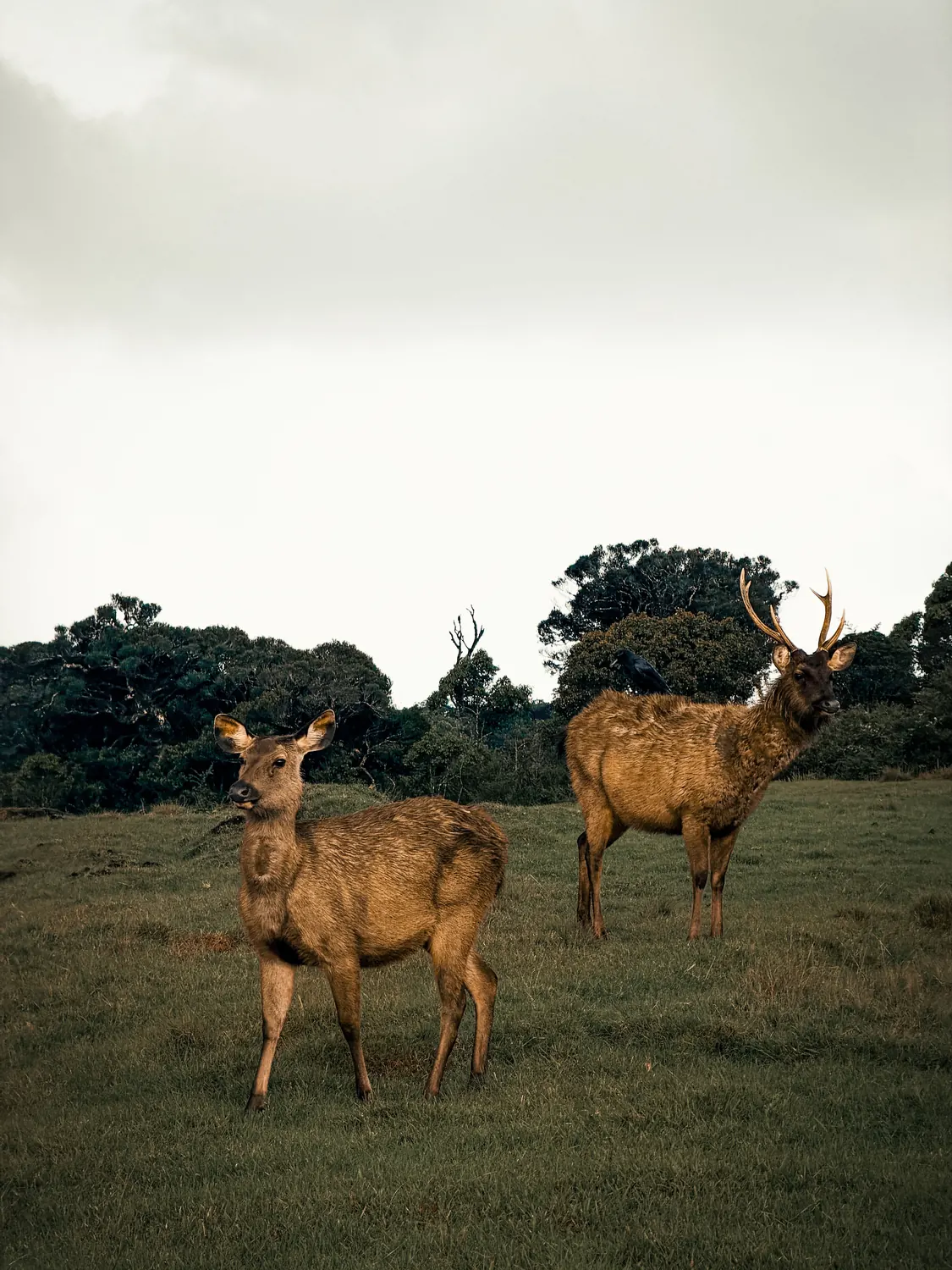
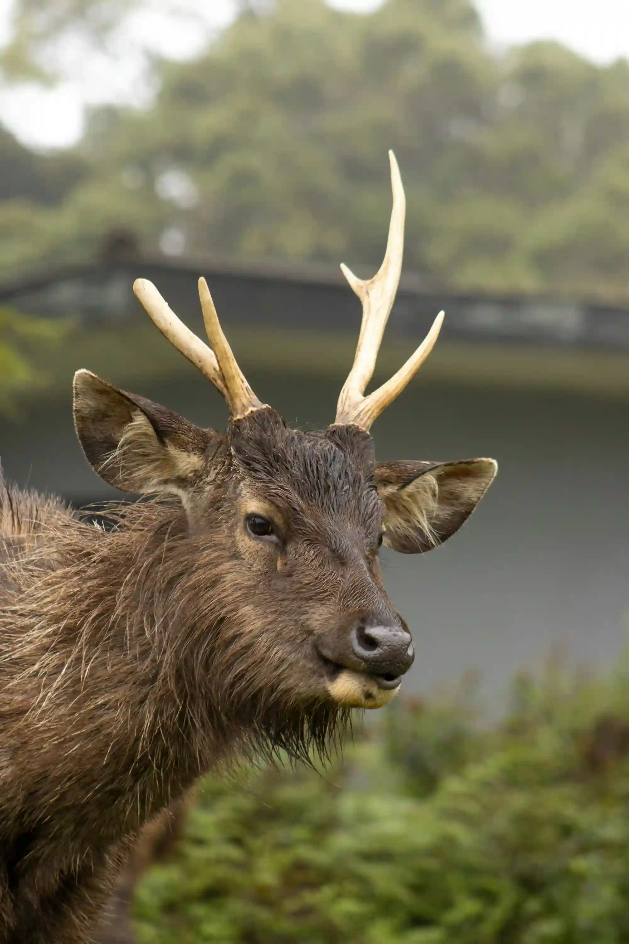
If you see one large mammal on this plateau, it will almost certainly be a sambar deer. The Sri Lankan sambar is the largest deer on the island and the defining large mammal of the plateau. Stags stand heavy and dark against the gold grass, coats damp with mist, antlers up. They are most active at the edges of the day, they favour the grassland–forest boundary, and they are used enough to people that a respectful approach on foot is often possible.
That last point comes with a serious caveat, which we come back to below: a sambar that is comfortable around humans is not automatically a sambar that is safe around humans.
The Leopard — Present, Rarely Seen
The Sri Lankan leopard (Panthera pardus kotiya) lives in these highlands and is listed among the park's noteworthy mammals. It is also very rarely seen by visitors. The terrain is dense, the cats are few and wide-ranging, and the walking trail is a fixed, well-used route. Pug marks and scat are a realistic hope; a sighting is a genuine rarity. Treat any operator promising leopards at Horton Plains with scepticism.
The Rest of the Highland Cast
The park's mammal list runs to roughly two dozen species and skews toward the small, the nocturnal and the endemic:
- Purple-faced leaf monkey (Semnopithecus vetulus) — the shaggy highland "bear monkey" subspecies is a Central Highlands speciality
- Toque macaque — Sri Lanka's endemic macaque
- Horton Plains slender loris (Loris tardigradus nycticeboides) — among the most endangered primates in the world, and so elusive that researchers from the Zoological Society of London only obtained the first photographs of it in 2010
- Kelaart's long-clawed shrew (Feroculus feroculus) — endemic, and a highland specialist
- Rusty-spotted cat and fishing cat — the rusty-spotted cat, one of the world's smallest wild cats, was recorded in the park at over 2,000 m in 2016
- Wild boar, barking deer (Indian muntjac), stripe-necked mongoose
- Giant squirrel (Ratufa macroura) and highland squirrel species
- Otter — a wetland visitor, and a good indicator that the streams are healthy
Sri Lankan elephants once ranged here too. They disappeared from the plateau by the 1940s.
A Paradise for Endemic Birds
For birdwatchers, Horton Plains is not a consolation prize for the absence of big mammals — it is the main event. The Horton Plains bird list is the reason serious birders build a whole morning around the park: it is a recognised Important Bird Area with around 87 recorded species, and the Department of Wildlife Conservation counts twelve endemic bird species within the park itself. Several highland endemics are difficult to find anywhere else on the island, which is why the park anchors most serious Sri Lanka nature and birding itineraries.
Endemics to Look For
Raptors including crested serpent eagle, mountain hawk-eagle and peregrine falcon hunt over the grassland, and migrants such as alpine swift pass through.
A birder's tip from the park's own trail guide. Arranga Pool, a small clear pool near the start of the Thotupola trail off the Pattipola road, is named for the Sri Lanka whistling thrush and is one of the better-known places to look for it. Early morning gives you the best chance. Around the pool, look also for the montane forest specialists: damba (Syzygium rotundifolium), keena (Calophyllum), giant tree fern (Cyathea walkeri), mihiriya (Gordonia ceylanica) and gal weralu (Elaeocarpus).
A Living Botanical Laboratory
Cold, wet and isolated for a very long time — these are the conditions that produce species found nowhere else. The park's flora runs to roughly 750 recorded plant species, and endemism among the woody plants is striking: of about 54 woody species recorded, roughly half are endemic to Sri Lanka. Around sixteen of the orchid species here are endemic too.
A few worth learning by name before you walk:
- Maha rathmal (Rhododendron arboreum) — scarlet rhododendron flowers, startling against grey mist
- Binara (Exacum trinervium) — the deep violet-blue highland gentian relative
- Nelu (Strobilanthes spp.) — the mass-flowering understorey shrubs that bloom in long, irregular cycles
- Endemic dwarf bamboo (Arundinaria densifolia) — dense thickets under the canopy
- Keena (Calophyllum walkeri) — a canopy dominant, and the species worst hit by forest dieback
- Giant tree ferns (Cyathea walkeri) — prehistoric-looking, and thriving in the permanent damp
The Small Lives in the Streams
The streams deserve a moment of their own, because they contain one of the most quietly alarming facts in Sri Lankan conservation.
Caridina singhalensis is a tiny endemic freshwater shrimp. It requires cold water — below about 15 °C — and it is now confined to roughly ten kilometres of a single stream system in these highlands. That is its entire world. There is nowhere cooler for it to go: it already lives near the top of the island.
A species restricted to cold water at the highest point of a tropical island has no upslope refuge left. In a warming climate, the shrimp in this stream is the clearest single indicator of what is at stake here — and it is invisible to every visitor who walks past it on the way to the viewpoint.
The streams also hold endemic crabs (Perbrinkia spp.) and endemic amphibians including Polypedates eques, Lankanectes corrugatus and a suite of shrub frogs. In the forest and on the rocks, look for the endemic agamid lizards: the rhino-horned lizard (Ceratophora stoddartii), the pygmy lizard (Cophotis ceylanica) and the black-cheeked lizard (Calotes nigrilabris) — all Central Highlands specialities, all easy to miss unless you are looking.
One footnote that says a lot about how these systems get altered: the only two significant fish in the park's streams — common carp and rainbow trout — are both introduced species, stocked in the colonial era and never removed.
World's End — More Than a Viewpoint
It is worth the walk. At World's End the plateau simply stops, and the land falls away in a sheer escarpment of roughly 870 to 880 metres — the exact figure varies between sources, but the effect does not. On a clear morning you can see tea estates, villages and reservoirs laid out far below, and on an exceptional one, all the way toward the southern coastal plain.
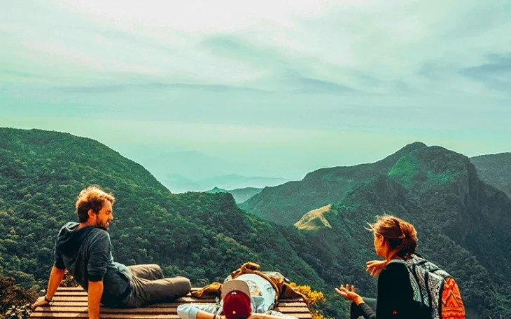
There is also a Mini World's End earlier on the loop, a drop of a few hundred metres, which most people photograph as a warm-up.
The single most important piece of planning advice for this park: go early. Cloud typically builds from mid-morning and can close the view entirely — often by around 09:30. Visitors who reach the viewpoint at 10 or 11 frequently see nothing but white. This is not a matter of luck that you can hope your way out of; it is a daily, predictable pattern, and it is the reason the park opens at 06:00 and the reason guides insist on the pre-dawn start.
Read as geology rather than as a photograph, World's End is the southern rim of the third peneplain — the point where Sri Lanka's central massif drops to the lower country in one step. It is the clearest demonstration on the island of just how abruptly these highlands rise.
Baker's Falls
On the return leg of the loop, the trail drops to Baker's Falls — about 20 metres high, wide, and thundering after rain. It is named after Sir Samuel Baker, the English explorer who founded the settlement at Nuwara Eliya.
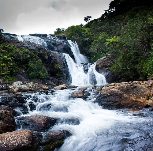
It is also the water tower made visible. The falls are fed by Belihul Oya, a stream that gathers from the peat, wetlands and forest soils you have just walked across, and which goes on to feed the Walawe Ganga. Standing at the base, you are looking at the direct output of the system this article is about: mist to moss to soil to stream to waterfall to river to reservoir.
The rocks around the falls are wet, mossy and genuinely slippery. Stay behind the barriers and on the viewing platform — people have been injured here.
The Walk Itself
The main circuit is a loop of roughly 9.5 kilometres taking in Mini World's End, World's End and Baker's Falls, and most people complete it in three to four hours at a steady pace. Allow longer if you stop for birds — and you should.
It is a walk rather than a climb: undulating rather than steep, on a marked path, with some uneven, rocky and root-crossed sections and a few sets of steps around the falls. Reasonable fitness and proper shoes are what it asks for. It is manageable for most people, including older children, though the early start is usually the harder part for families.
Walk it anti-clockwise. Doing so reaches the viewpoints before the cloud arrives and saves the falls for the way back.
Beyond the Loop: Two Trails Most Visitors Never Walk
The World's End circuit is not the only trail in the park, and the Department of Wildlife Conservation publishes guides to two others. Both require arrangement with the park office, and both reward anyone who wants the plateau without the crowd.
Thotupola Kanda
2,357 m · about 3 km return · roughly 3 hours
Starting near the Pattipola road entrance, this short trail climbs gently through montane forest into the pygmy forest and out to the summit of Sri Lanka's third-highest peak, with the Pidurutalagala range to the north and the whole patana mosaic to the south.
By legend it is one of the landing places of the Dandu Monaraya, the flying machine of the pre-historic king Ravana — the name itself means, roughly, "port mountain".
Kirigalpoththa
2,389 m · about 11 km return · a full day
The serious one. Beginning near Far Inn, the trail crosses grassland, a peat bog, stream valleys and montane forest before a steep final climb to Sri Lanka's second-highest summit. The park's guide is explicit that the last section demands extreme caution — this is real highland trekking rather than a nature walk, and it belongs on an adventure itinerary rather than a sightseeing day.
The name means "milky rock", for the pale exposed rock face on the mountain's northern slope. On a clear day the summit gives Adam's Peak and a very large share of the country.
The Kirigalpoththa trail also passes through some of the best butterfly habitat in the park — the DWC guide names blue admiral (Kaniska canace), red helen (Papilio helenus) and Ceylon tiger (Parantica taprobana) among the species along the way — and the Slab Rock pool, where the endemic highland shrimp live.
The Forest Is Dying in Places, and Nobody Is Certain Why
You will walk past it without necessarily registering what you are seeing: stands of bare, silvered, standing dead trees, still upright, with grassland creeping in beneath them. The park's own trail guide marks one section simply as "forest dieback area".
Forest dieback was first reported at Horton Plains around 1978 and has been studied ever since without a settled conclusion. Peripheral areas have lost a large share of their canopy, and Calophyllum walkeri — a dominant canopy tree — has been hit hardest. The candidate explanations overlap rather than compete:
- Climatic stress — the severe drought of 1976 is often cited as a trigger, compounded by frost and persistent wind exposure at this altitude
- Soil chemistry — research has pointed to nutrient deficiency, low calcium in highly acidic soils, and consequent aluminium and magnesium toxicity
- Atmospheric deposition — elevated lead and cadmium have been measured in dieback-affected soils, above tolerable levels for affected tree species
Interestingly, the forest showed signs of recovery after the heavy rains of 1983–86, which supports the water-stress explanation without settling the argument. What is not in doubt is the direction of travel: a montane cloud forest that depends on reliable mist is a poor candidate for a future of hotter, more erratic weather. If the cloud base lifts, the forest stops being watered by fog.
The Other Pressures
The invasive species problem is worth understanding, because it is the one visitors most directly influence. Gorse and blue stars spread into disturbed ground, and seeds travel on boots, bags and tyres. Staying on the trail is not merely a rule about tidiness — it is one of the few things a visitor can do that measurably helps.
Visiting Responsibly
Horton Plains enforces its rules more strictly than most Sri Lankan parks, and it does so for good reason.
- Polythene and single-use plastic are banned. Bags are searched at the entrance and plastic wrapping is removed from food before you go in. Do not treat this as an inconvenience — it followed sambar deaths from plastic ingestion.
- Stay on the marked trail. Fines are issued for straying. It protects fragile vegetation and limits the spread of invasive seed.
- Never feed the animals. Habituated sambar are the ones that come to harm.
- Carry everything out. There is no waste system inside the park, and cold, wet conditions mean litter degrades very slowly.
- Keep quiet. Noise is the single biggest reason people see nothing. It also ruins the experience for everyone within earshot.
- Alcohol is prohibited, and so is removing any plant, flower or rock.
Practical Information
Entrance fees, permitted entry times and vehicle rules are set by the Department of Wildlife Conservation and change periodically. Confirm current rates and conditions before you travel.
Where Horton Plains Fits in a Sri Lanka Itinerary
Horton Plains works best as an early-morning excursion from a hill-country base, slotted into a journey that is already heading through the Central Highlands. It is not a destination you build a week around; it is a half-day that will be one of the most memorable of the trip.
Who Should Go
Protect the Mist, Protect the River
Horton Plains does several jobs at once, and only one of them is tourism. It stores carbon. It regulates local climate. It holds soil on very steep ground. It shelters species that exist nowhere else on Earth. And it makes water, reliably, for a country that needs it downstream.
Those jobs are linked in a single chain, and the chain runs in one direction only:
Protect the forest → protect the mist → protect the soil → protect the streams → protect the rivers → protect the communities
Break it at the top and it fails everywhere below. That is the reason this small plateau — three thousand hectares, a morning's walk, a viewpoint that is often full of cloud — carries a weight out of all proportion to its size.
So go early. Walk quietly. Take your rubbish home. And when the mist comes down and hides World's End, as it often will, understand that you have not missed the point. You are standing inside it.
Horton Plains: Frequently Asked Questions
How long is the Horton Plains hike?
The main circuit is about 9.5 kilometres, taking in Mini World's End, World's End and Baker's Falls. Most walkers complete it in three to four hours, and longer if they stop for birds and photography.
What time should I arrive at Horton Plains?
As close to the 06:00 opening as you can manage. Cloud usually builds from mid-morning and often closes the view at World's End by around 09:30, so an arrival at 10:00 or later frequently means seeing nothing but white.
Can you see leopards at Horton Plains?
Sri Lankan leopards live in these highlands, but sightings by visitors are genuinely rare. The terrain is dense, the cats range widely, and the trail is a fixed route. Sambar deer are close to guaranteed; leopards are not, and any operator promising them should be treated with scepticism.
Is Horton Plains difficult to walk?
It is a walk rather than a climb. The loop undulates on a marked path with some uneven, rocky and root-crossed sections and steps near Baker's Falls. Moderate fitness and proper shoes with grip are what it asks for.
What should I bring to Horton Plains?
Walking shoes with grip, a warm layer, a light waterproof, water, sun protection, binoculars and a camera. Temperatures near freezing at dawn and strong sun by 10:00 on the same morning is normal. Polythene and single-use plastic are banned and will be removed at the entrance.
Is Horton Plains worth visiting if it is misty?
Yes, though adjust what you expect. The escarpment view may be hidden, but the cloud forest, the grassland, the streams, Baker's Falls and the wildlife are all unaffected — and the mist is the ecological engine that makes the plateau what it is.
Sources and Further Reading
- Department of Wildlife Conservation, Sri Lanka — Trail Guide to Kirigalpoththa and Trail Guide to Thotupolakanda, Protected Area Management & Wildlife Conservation Project, prepared with the technical assistance of the IUCN Sri Lanka Country Office (park introduction, biodiversity, cultural heritage, trail segments, access routes and visitor guidance)
- UNESCO World Heritage Centre — Central Highlands of Sri Lanka, inscribed 2010 under criteria (ix) and (x): whc.unesco.org/en/list/1203
- IUCN World Heritage Outlook — Central Highlands of Sri Lanka conservation assessment: worldheritageoutlook.iucn.org
- Ministry of Environment, Sri Lanka — Horton Plains National Park, Wetland and Forest Resource Conservation documentation: env.gov.lk
- Chandrajith, R. et al. — "Major and trace elements in plants and soils in Horton Plains National Park, Sri Lanka: an approach to explain forest die back", Environmental Geology (soil chemistry and dieback): link.springer.com
- Werner, W. L. — "Canopy dieback in the upper montane rain forests of Sri Lanka", GeoJournal (drought, frost and wind as dieback factors): link.springer.com
- Lakkana, T. et al. — "Tropical montane forest in South Asia: composition, structure, and dieback in relation to soils and topography", Ecosphere (2022): esajournals.onlinelibrary.wiley.com
- Sri Lanka Tourism — Horton Plains destination information: srilanka.travel
- Photography — field images of Horton Plains by Thilina Alagiyawanna, Ravishka Samarakoon, Arul Karki and Wickypix, via Pexels
- Perera, N. P. (1969) — classification of Sri Lanka's upper montane grasslands (wet patana), as cited in Department of Wildlife Conservation park literature
Where sources differ — notably on annual rainfall, the exact height of the World's End escarpment and the precise date of national park designation — this article reports the range rather than picking a single figure. Park entry fees, opening times, permitted trails and vehicle rules are set by the Department of Wildlife Conservation and change from time to time; confirm current conditions before travelling. Weather in the Central Highlands changes quickly, and wildlife sightings are never guaranteed.
Photo Gallery
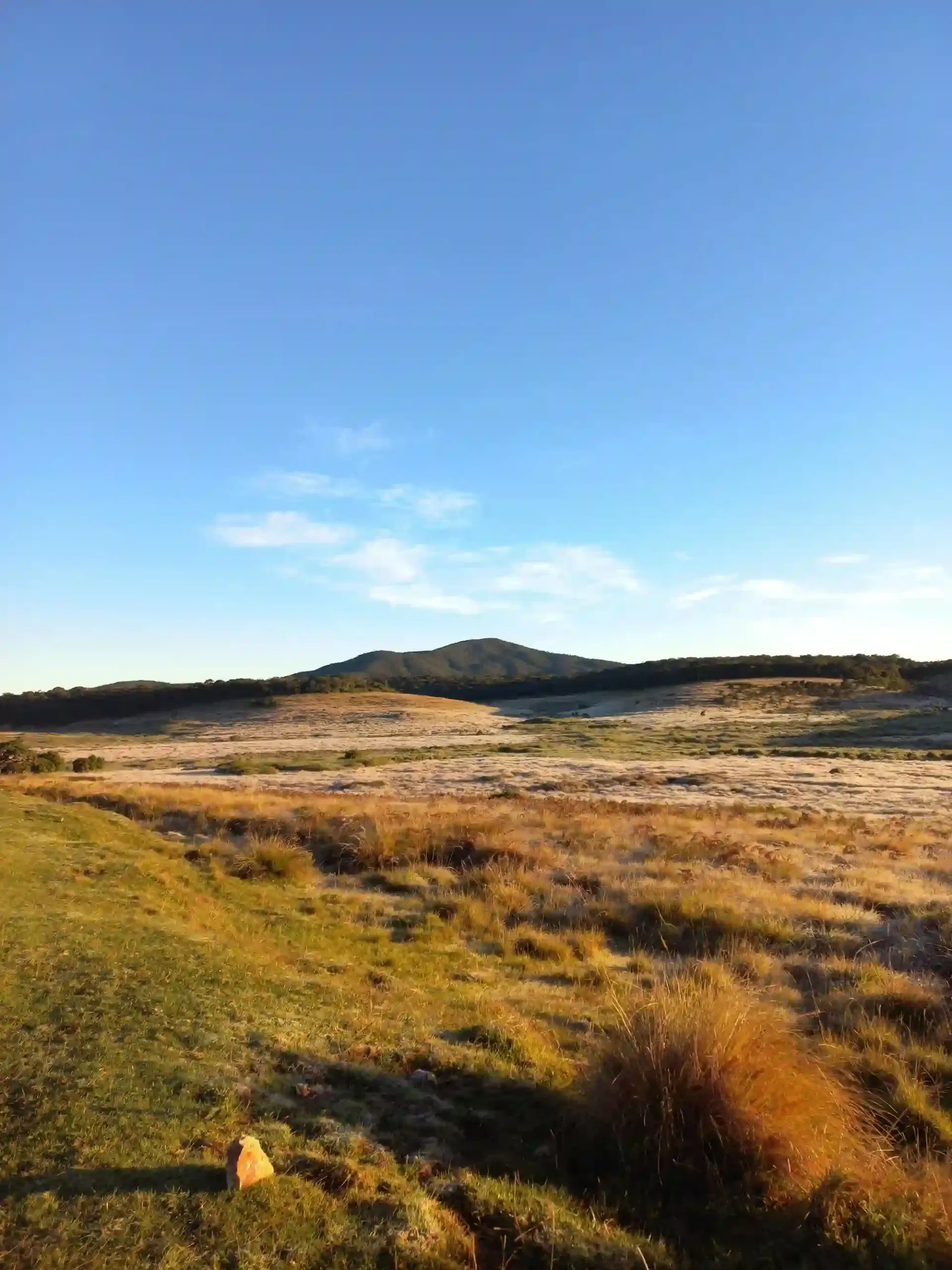
Frost on the Patana at Dawn
Ground frost across the montane grassland at first light. At around 2,100 metres, February mornings here regularly fall close to freezing.
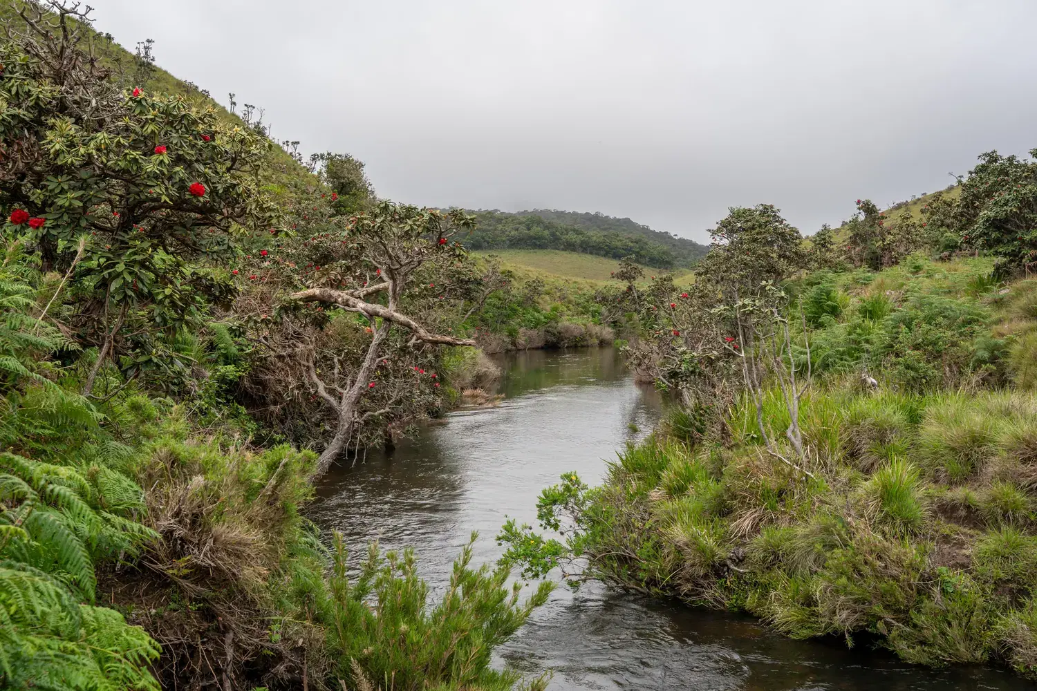
The Mist That Gives Life
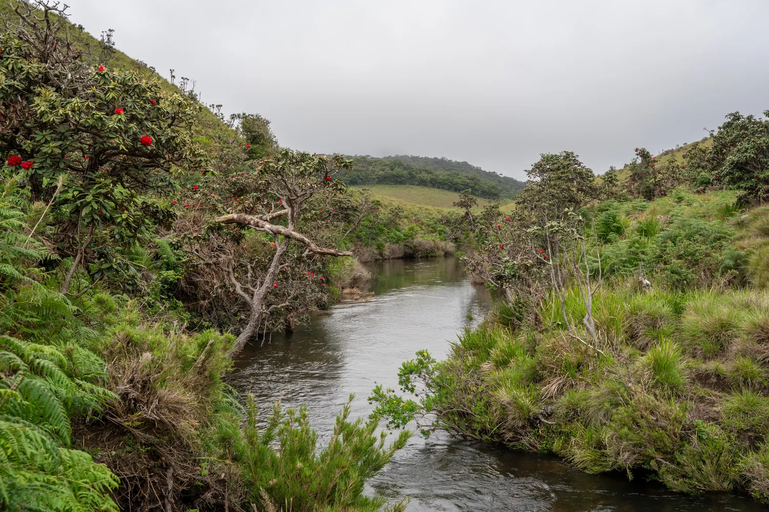
Low cloud on the plateau and a headwater stream running clear beneath flowering maha rathmal — the cloud forest water cycle in a single frame.
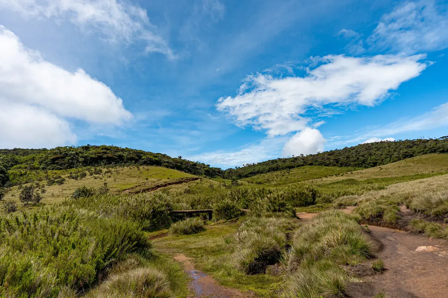
A Headwater Stream
Water held by soil, peat and tussock grass before it is released. Streams like this one feed the Mahaweli, the Kelani and the Walawe.
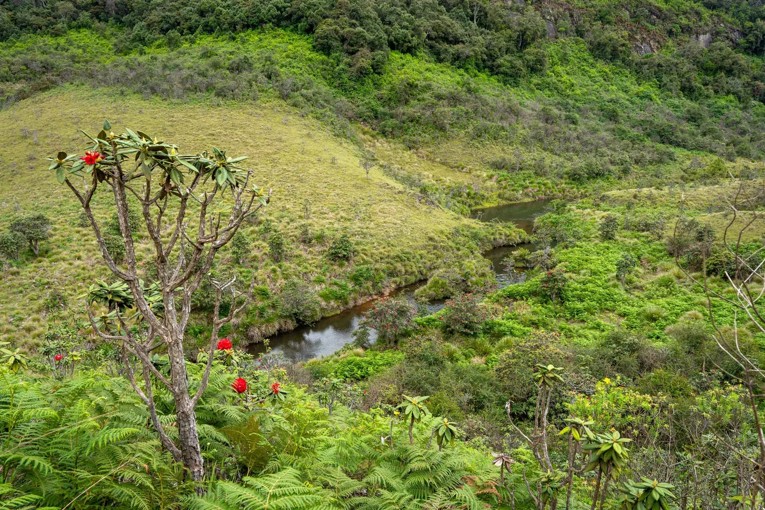
Grassland, Forest and Tree Ferns
The Horton Plains mosaic: open patana, dark montane forest on the far slope, tree ferns and scarlet rhododendron above a stream valley.
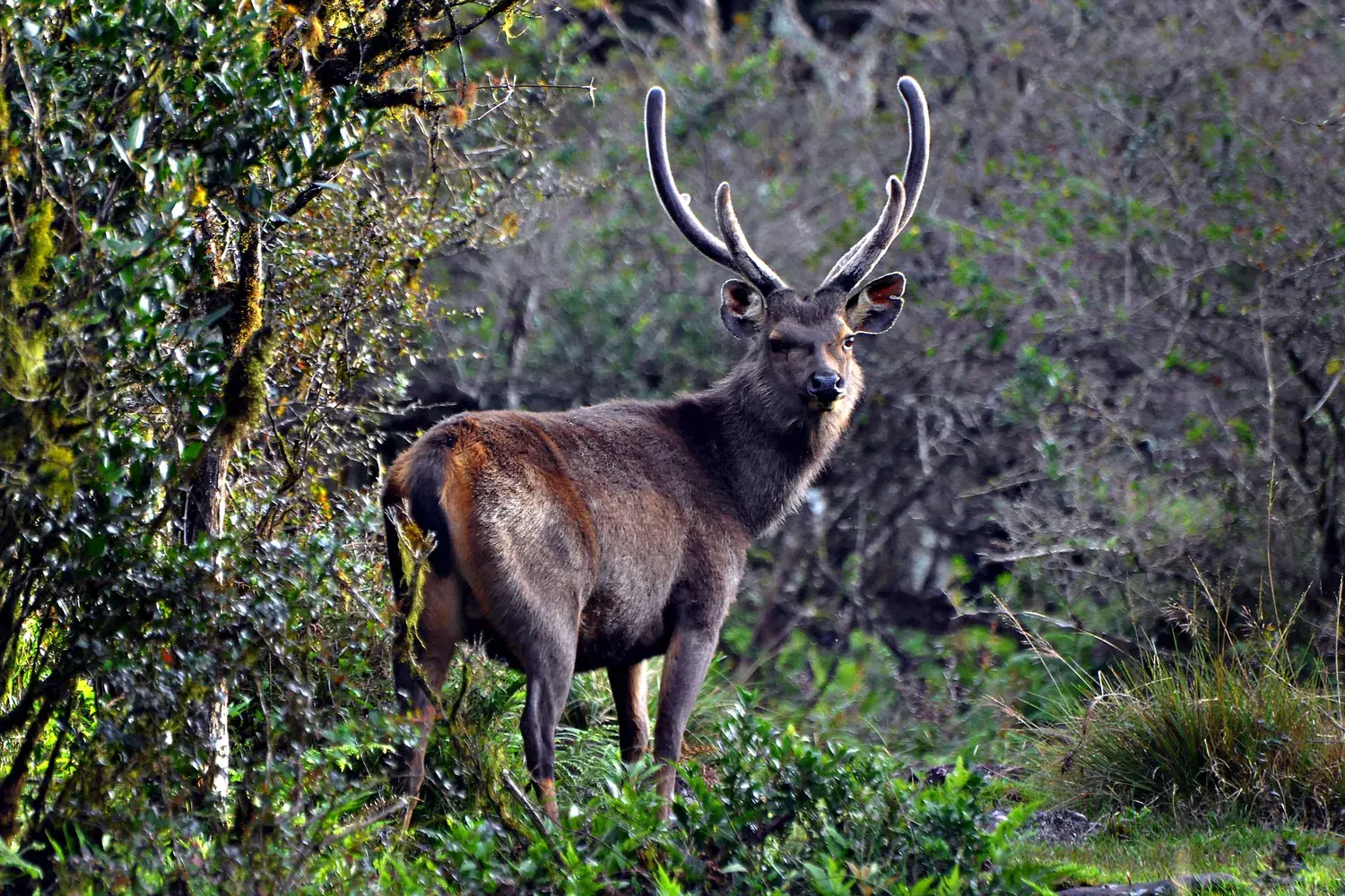
Sambar Stag at the Forest Margin
The Sri Lankan sambar is the park's defining large mammal, with an estimated 1,500 to 2,000 animals on the plateau.
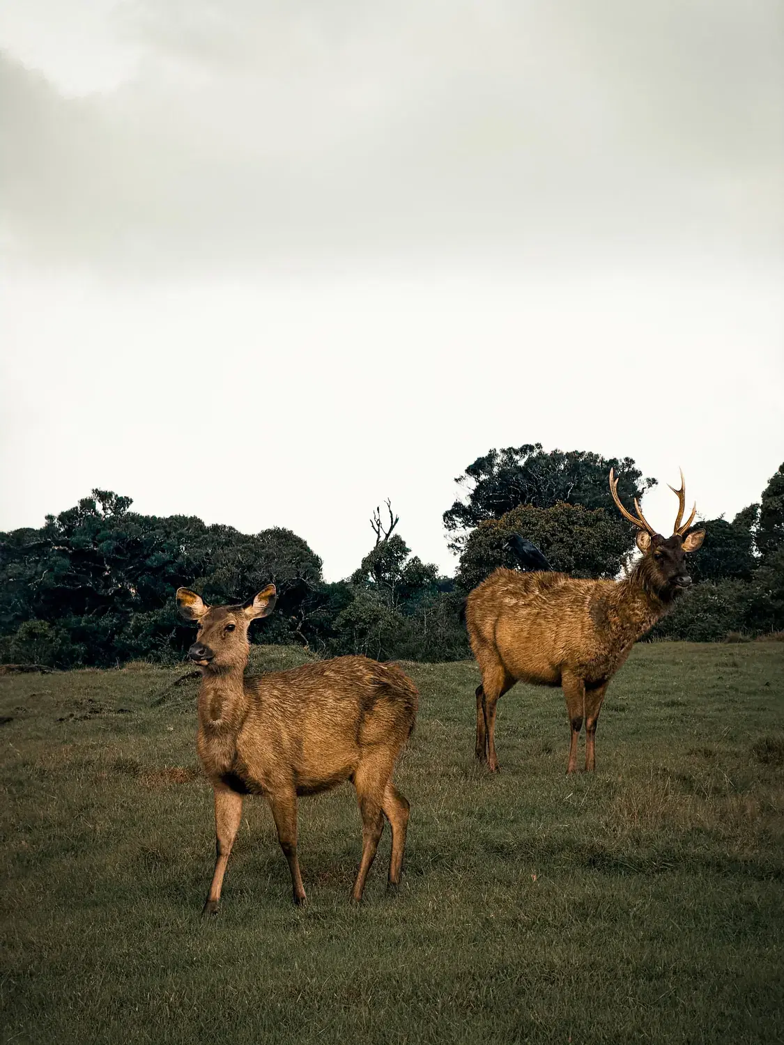
The Grassland–Forest Edge
Sambar on open grazing a few steps from the cover of the montane forest — the boundary where most sightings happen.
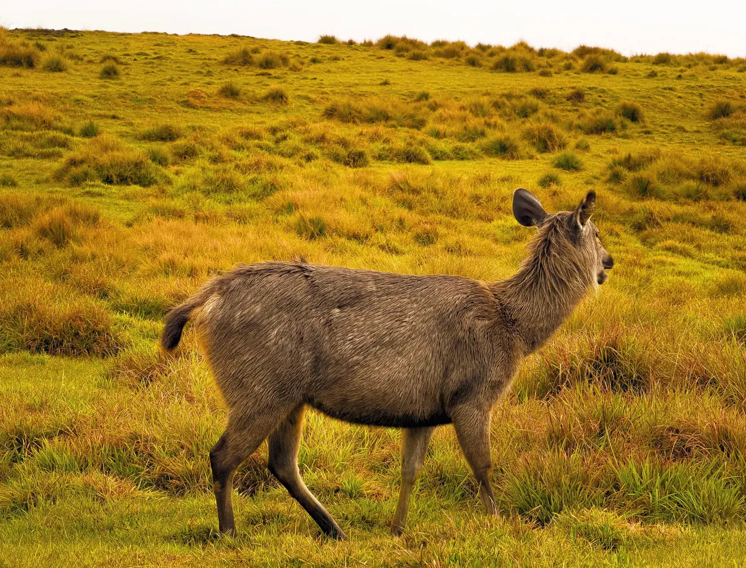
Sambar Hind in the Tussock Grass
Upper montane grassland, classified as wet patana, covers roughly two-thirds of the national park.
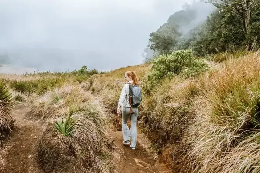
The Nature Trail in Mist
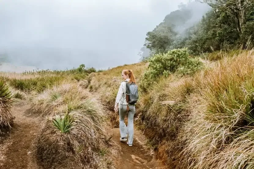
The main loop crosses open grassland before entering cloud forest. Mist can close and clear the landscape within minutes.
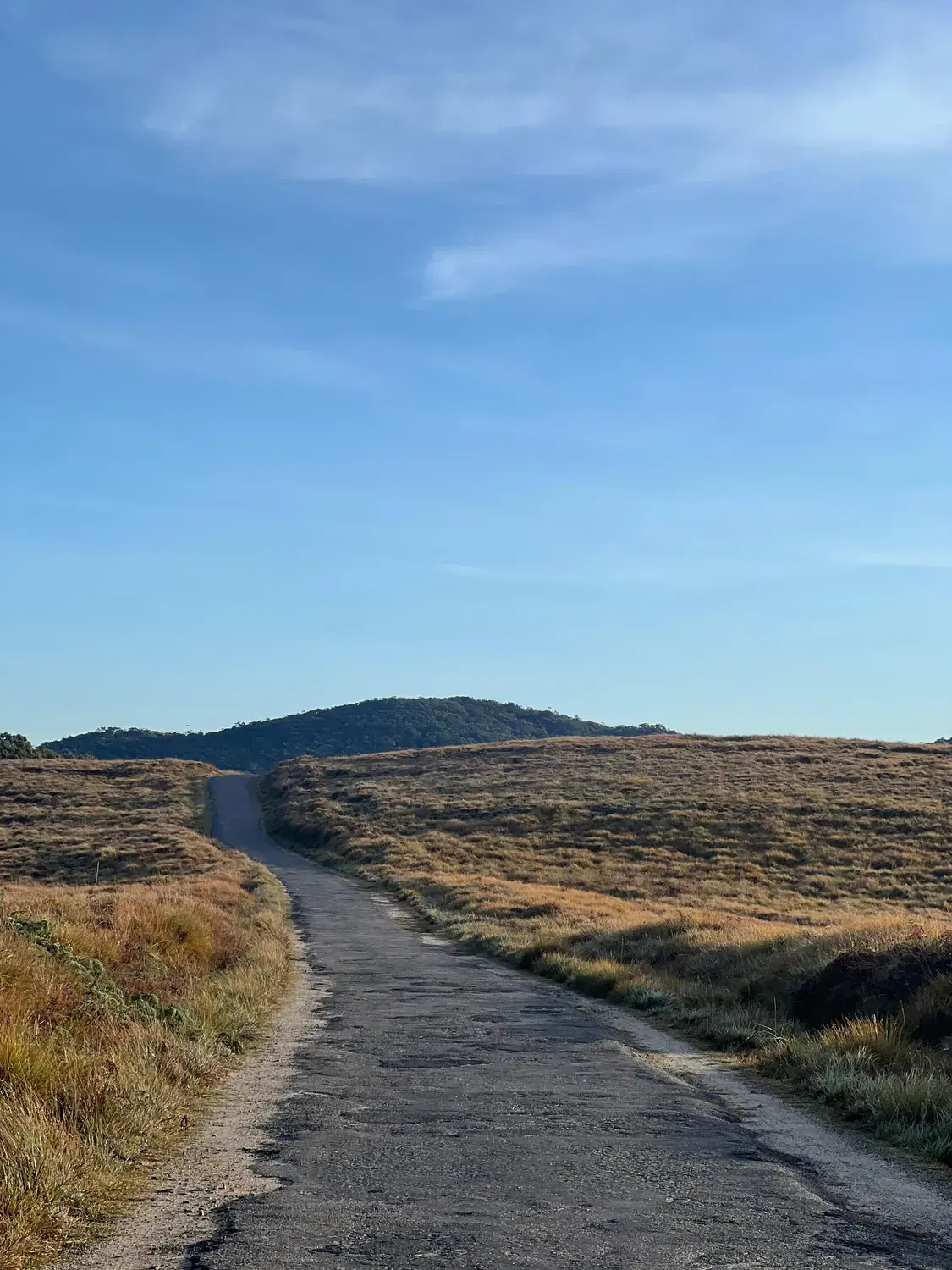
The Road Across the Plateau
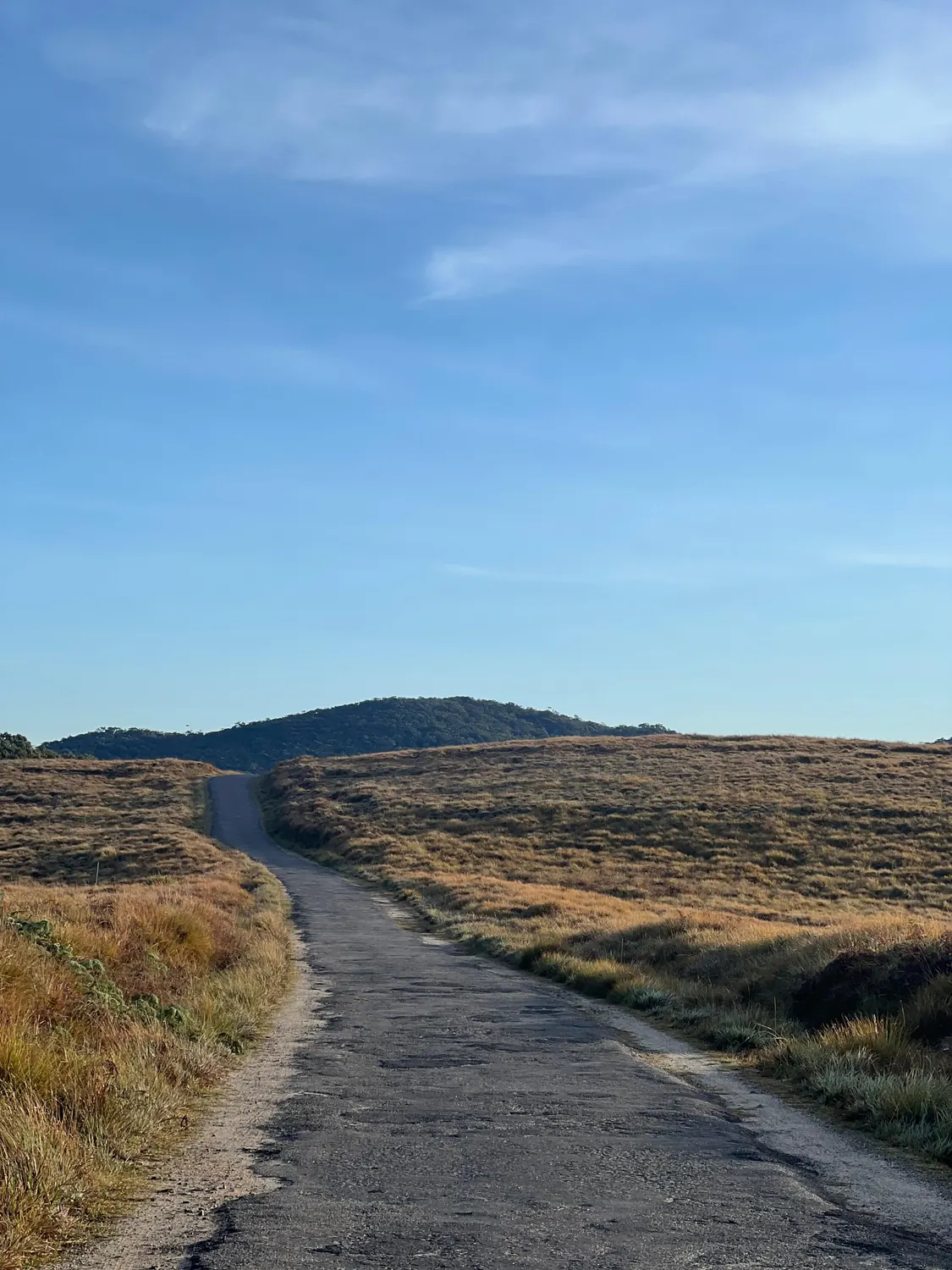
The park road between the Pattipola and Ohiya entrances, which most visitors drive in the dark on the way to World's End.
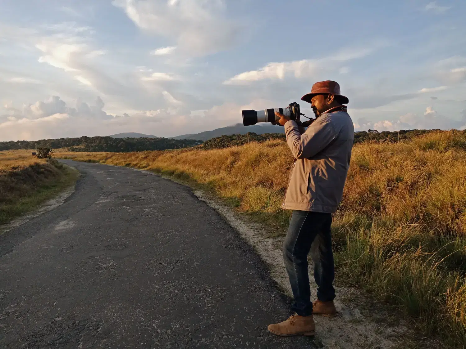
Golden Hour on the Plains
The first and last hours of light do the most work here, for photographers and wildlife watchers alike.
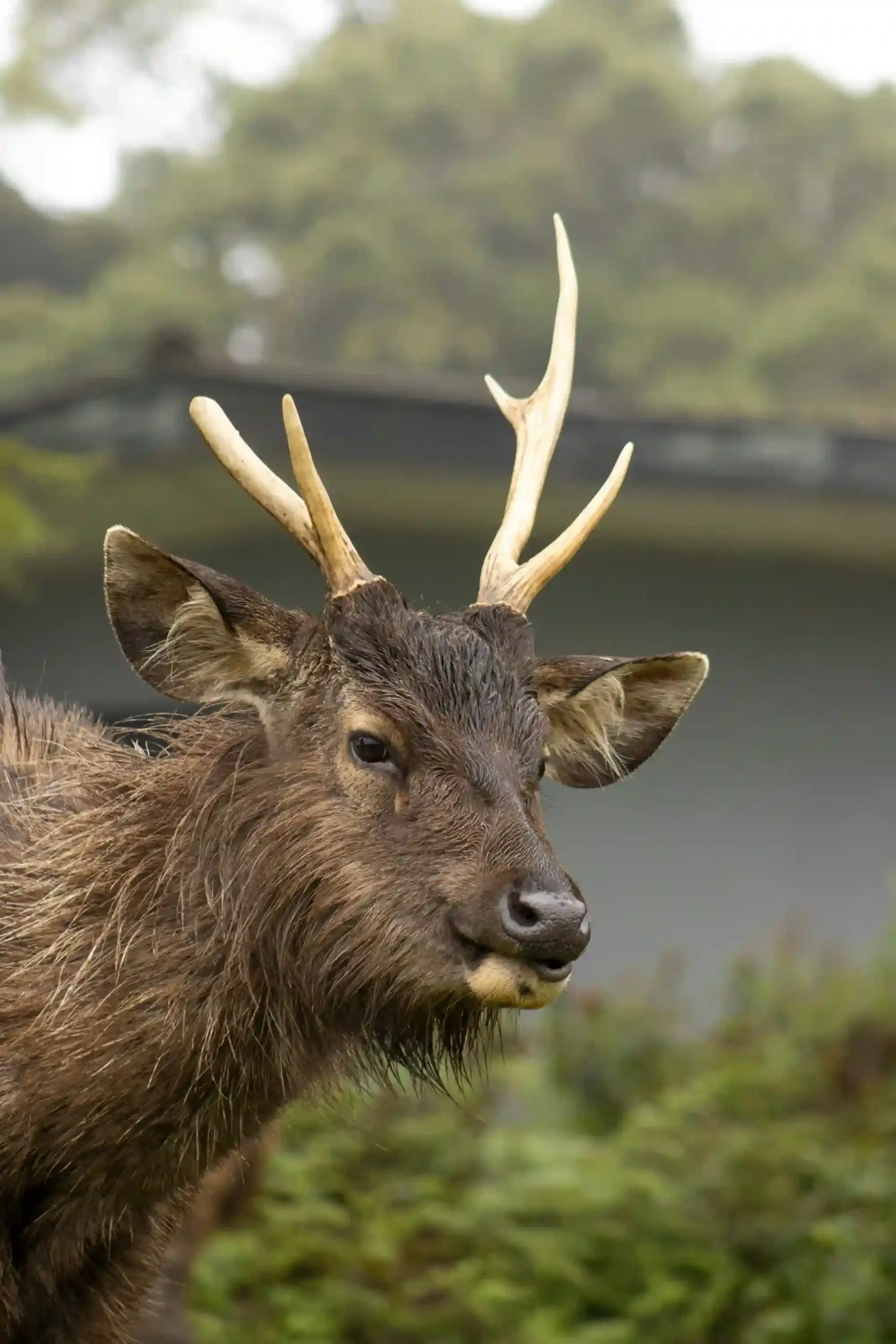
Habituated, Not Tame
Sambar near the park buildings are used to people. Feeding them, or leaving plastic behind, is how highland wildlife comes to harm.